One Last Passage Before Home
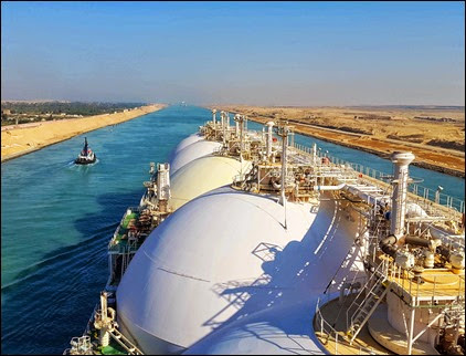 Our vessel during the northbound transit
This is it.
This is the time when the real countdown to home should begin. January next year would be a very busy month for us. Our ship is scheduled for dry dock in Qatar during that time. Luckily, we won’t be on board when everyone is dissecting the vessel, when everyone is changing her spare parts or painting and greasing some of her machineries, which, is actually the goal of this dry dock thing.
Last night, our Croatian third officer showed us the updated schedule of our disembarkation next month. According to the email, our disembarkation which is supposedly on the third week of January was rescheduled on the first week (yay!). Imagine the excitement of my crewmates when they received the news. Still, we have to bear in mind that it could be changed, unless we already have our plane tickets or unless our relievers start knocking on our cabin doors.
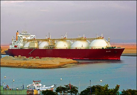 A rare shot of our vessel in the canal. See those five domes? I sometimes imagine them as giant dumplings, only stuffed with LNG.
Anyway, this blog post is not about our impending goodbyes to our floating home and workplace. I actually want to write something about a well known canal in Egypt, the Suez Canal. We will be transiting there on the twelfth of December and that would be my last canal passing for this voyage. And with that transit, I guess that would mark the beginning of my countdown.
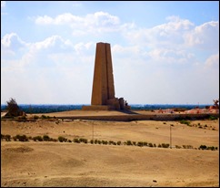
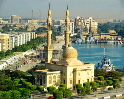 One of the prominent structures in the southern entrance of the canal is this building, the Badr Mosque.
So, let’s try to have a closer look to the history, geographical location and relevance of the Canal, and of course, some of my moments during the transits.
Basically, the canal was built to connect the Red Sea and Mediterranean Sea. But during the old times, canals that were dug from east to west connect the two seas through the branches of the Nile river. It is said that this concept dated since the time when pharaohs ruled Egypt and not until 1799 when the first efforts were made to build a modern canal from the Egypt expedition of Napoleon Bonaparte. Bonaparte believed that such canal would inflict trading dilemmas to the English, specially when the French take hold of the shortest route to the east. (Nice one, Mr. Bonaparte).
It is only in the mid-1800 when a successful attempt was made by Ferdinand de Lesseps, a French diplomat and engineer to build a canal when he managed to gain support from Said Pasha, the Egyptian viceroy, for the project. Thus, in 1858, the "Compagnie Universelle du Canal Maritime de Suez" (Universal Suez Ship Canal Company) was formed to start the construction of the canal and become the authority for its operation.Since then, the company was owned by Egyptian and French interests, but the ownership would be taken over by the Egyptian government after 99 years.
The actual building of the canal began on April 25, 1859. On November 17, 1869, it was opened for ships that will be transiting between the Red and Mediterranean Seas. The canal was closed for five times mainly because of conflicts and other political reasons. However, it was reopened for navigation on June 5, 1975.
You might wonder about the total length of the canal. Well, it extends from end to end a total of 101 miles (162 km), and the average time for passage, usually by convoy (2 southbound and 1 northbound daily, maximum 40 ships per convoy except the 2nd southbound has a maximum of 15 vessels) is 14 hours for the southbound and 10 hours for the northbound. I find it surprising that almost every Egyptian mooring men that I met know about the Suez Canal facts and figures, such as these.
The northern or Mediterranean entrance of the canal is situated at Port Said and the southern or Red Sea entrance is at Port Tewfik. During the beginning and the end of the transit, these two ports are the prominent and busy areas on both ends of the canal. The canal also cuts through three inland lakes namely, Lake Timsah, the Great Bitter Lake and the Little Bitter Lake.
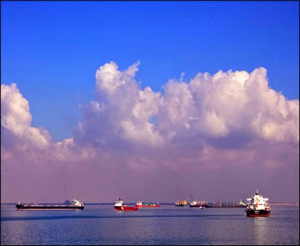 Ships usually anchor for few hours inside the Bitter Lakes during the southbound transit. I just can’t help but wonder why these two inland lakes were named ‘bitter.’
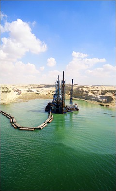
Transiting northbound, you can see lush greeneries and residential areas on the western side. On the eastern side however, sand dunes and hills extend farther north. You might also be able to see trucks and other heavy duty vehicles on the eastern side. One mooring man told me that a project is ongoing to widen and deepen the canal to accommodate more vessels per day.
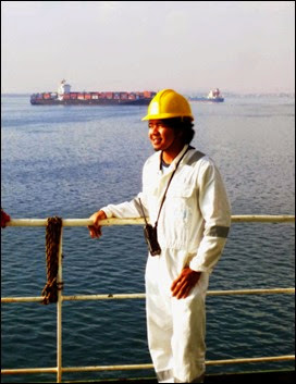 Naks. That was me while we were on the Great Bitter Lake anchorage.
During the canal passage, we are either on duty doing hand steering on the bridge or having our rest for the day until our watch time. Though we don’t have all the time to do sightseeing, we still manage to catch a glimpse of what life is like on the canal. From time to time, you can see small barges crossing the canal from one side to the other and some fishing boats drifting for hours especially inside the lakes. We are also able to buy some Egyptian handmade souvenirs, even if we are not leaving the ship, since mooring men that come onboard sell various items ranging from figurines to cheap electronic devices.
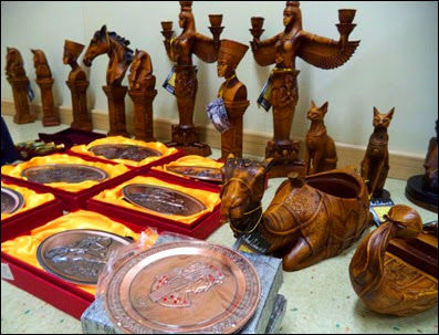 Mooring men usually bring with them some items that you can buy depending on agreed prices. So every time they come on board, we show them the Pinoy ‘tawad’ skills.
With the strategic location of the Suez Canal, it plays an important role in trading, much more in the maritime industry. Almost 8% of the world’s sea trade takes place on the canal. And since it practically provides shortcut route from east to west, it thus enable vessels passing through it that carry cargoes to different parts of the world to save both time and money.
I find it funny that the concept of the modern-day Suez Canal started with the whim of giving problems to other people. Nevertheless, this man-made waterway has gone through time and became witness of some of the world’s historical events . Today, it continues to provide efficient route to connect east from west, a feat made possible by minds from the past.
So where am I again?
Okay. Let me begin my countdown.
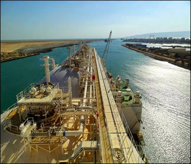 Our ship approaching the southern entrance. Few minutes of steering and we are out to the Red Sea.
Sources: Lloyd’s Maritime Atlas of World Ports and Shipping Places, 27th Edition
Suez Canal Authority (2008). The Canal. Canal History. Retrieved January 10, 2014, from the SCA website: http://www.suezcanal.gov.eg/sc.aspx?show=8
Amanda Briney (2014). Suez Canal Connects the Red Sea with the Mediterranean Sea. Retrieved January 10, 2014, from About.com website: http://geography.about.com/od/specificplacesofinterest/a/suezcanal.htm
Photos: Courtesy of my crewmates Jasper and Lei Ming
